
This Week's Maps #4: How to Map The Sea
How do you draw a map of a three-dimensional space?

Greetings friends!
I’ve found myself drawing a fair few coastal or island-heavy maps recently, which means drawing a lot of ocean.
The routine for oceans is pretty simple: draw some thinner lines shadowing the coast, colour it darker than the land, add a sea name if there is one, and you’re done. But recently I saw someone mention the subject of reefs and how to represent them on maps, which made me think a little more: how do we map things in the sea? And even more interestingly (in my view): how do we map the sea itself?
Conventuional land maps are made simpler by the fact that most things exist at ground level, especially in low-tech fantasy settings. You might encounter the odd dungeon complex or floating island, but those can be charted in a separate map or a smaller inset one. The ocean, though, is a 3D space, notoriously difficult to chart.
Well, like many others I’m sure, I’ve recently been playing Two Point Museum - which contains an ocean map!
It’s amazing how often maps pop up in our daily lives, isn’t it? Even as someone who does this professionally, I’d been using the Two Point map in-game for hours before I realised its significance.
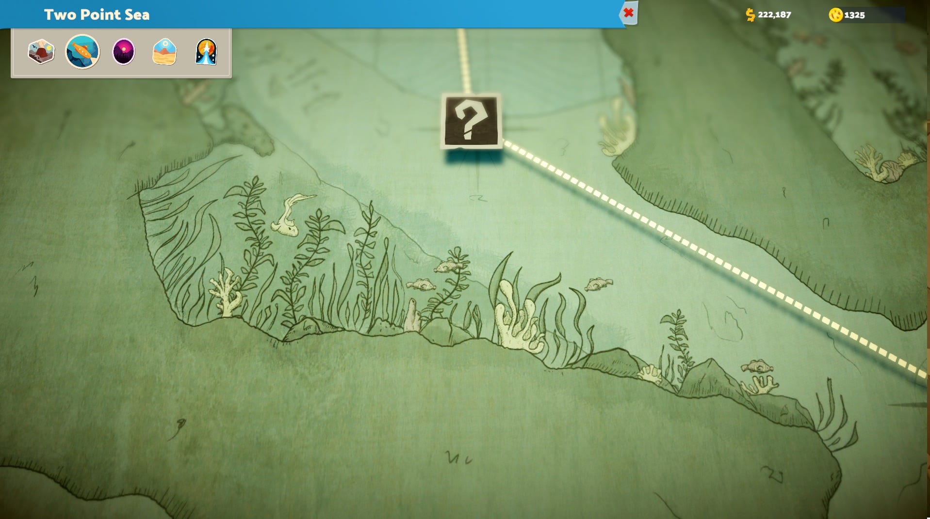
I’ll attach some screenshots here for you to oogle at.
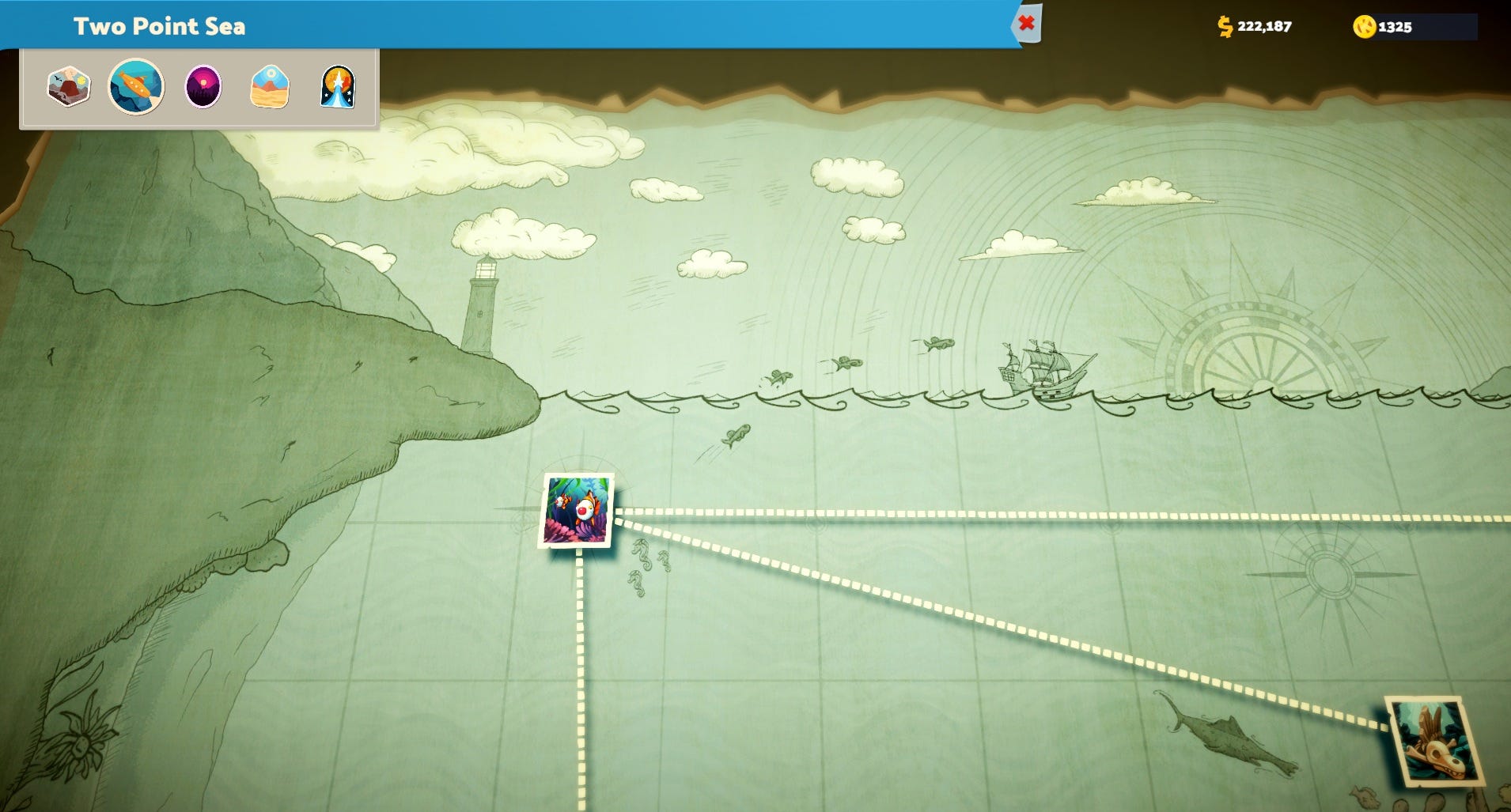
I love the idea of mapping the ocean from the side. In many ways, the significance of an ocean world is not where you are on the seabed, but how far you are from the surface, so turning everything on its side (literally) is a great, innovative approach, one I took lots of pleasure in exploring.
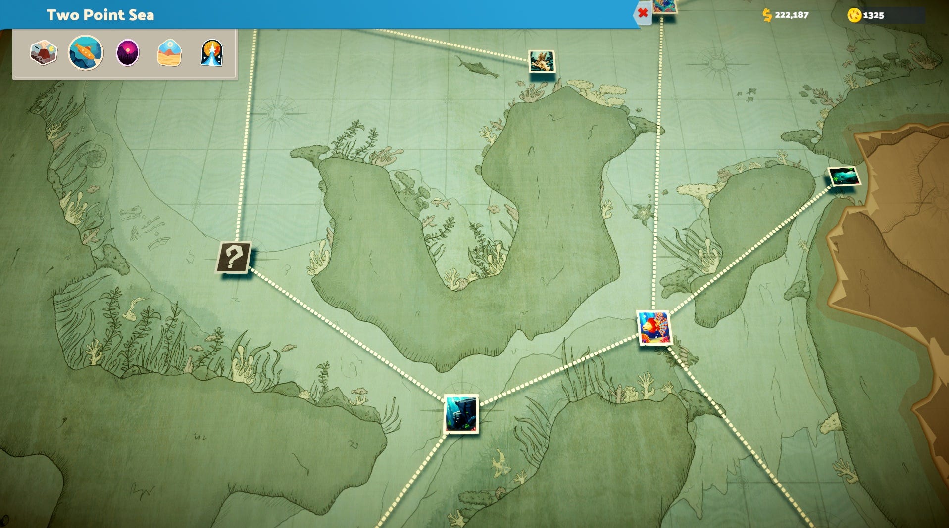
This gives us a strong sense of exploration as we delve deeper and deeper into the ocean, down into underwater caves and between cramped rocks and twisty forests of submerged plants. Plus, it gives the artist ample opportunity to embellish the map with doodles and fun little details, which I had lots of fun scrolling around to find. Look at the little fishes!
Anyway, this side-on technique is one I’m folding away in my back pocket - inspiration I can draw on if I ever need to draw a map that charts the deep sea floor.